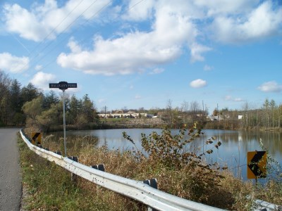
Halligan’s Pond
Patrick Halligan settled on lot 16, front concession 9, which was farmed next by W. Cassin. The pond has an interesting story about its origin. Originally, concession 9 went straight south from the current Victoria Road. When the pioneers were clearing this farm, they pulled stumps from the field next to the road bank on the east side of the pond only to return to find that a spring had been uncovered and water had flooded the pioneer road completely.
The 1861 Leslie map of the Township shows the Halligan’s Pond is on this property and the 1877 Wellington County Atlas map of the Township shows Cassins. Both maps show the original road going straight through. By the 1906 atlas’s map, the jog in the road and Halligan’s Pond appear. Cassin was the owner in 1906. By 1950 this farm was owned by the Haughs. In the 1990s, on a flight that circled over Puslinch, Robert McFarlane was able to see the original pair of wheel tracks from the early road still visible under the water.
Most recently, in 2013 Halligan’s Pond was marked by a Puslinch Heritage road sign as a natural heritage feature of the Township.