Local History
Discover the local history of the Township of Puslinch. Whether you are a curious resident wanting to deepen your understanding with some of our community’s heritage, or a visitor intrigued by our past, we welcome you to learn more about some of the local history of Puslinch.
Early Local History
What is currently known as Brock Road/Highway 6 South was once the main artery leading from Dundas to John Galt’s new settlement of Guelph established in 1827. Land surveyor David Gibson did two separate surveys from 1828 to 1832. Concessions I to VI on the west side of the Township run from east to west, parallel with the Gore to Wentworth County. Concessions VII to XI run northwest to southeast.
Natural heritage features in Puslinch played a role in settlement with the First Nations people who lived in this area, and later with the European settlers. As farmsteads filled in, the settlers built grist mills and sawmills from the dams they created along the natural waterways.
A large majority of the early settlers in the Township were Highland Scottish. Other groups included settlements of Germans in Morriston, English in Arkell and Irish Catholics in the Downey Road and Brock Road areas. The Township was not always recognized by the name we know today. Throughout history, Puslinch was identified by many different names such as Puselynch, Posselinch, and Puzzlewitch.
In the last century, many noteworthy organizations have been founded in the Township. Some of these organizations are the Aberfoyle Agricultural Society, Farmers’ Institute, Plowman’s Association, Women’s Institute, Red Cross, Mutual Fire Insurance, Patrons of Industry, Ancient Order of United Workmen, Sons of Scotland, Independent Order of Foresters, Board of Health, Aberfoyle Athletic Club, Progressive Club, Horticulture Society, Morriston Public Library, and Aberfoyle Literary Society.
Architectural Heritage Features
The Township of Puslinch is home to a variety of historical architectural examples of master masons’ and carpenters’ work. On close examination of the plaqued sites in the Township, it is easy to see how each tradesman left his mark – both enduring and irreplaceable.
As in the rest of Upper Canada, the first buildings here were constructed of logs. Once sawmills were in place, a second stage of building followed. Frame structures became common as villages expanded, and early log barns were replaced on farms with larger Swiss-style barns. Waterloo County, to the west of Puslinch, had been settled 30 years earlier and Puslinch farmers contracted to have barns built in the style of their Pennsylvania-German neighbours.
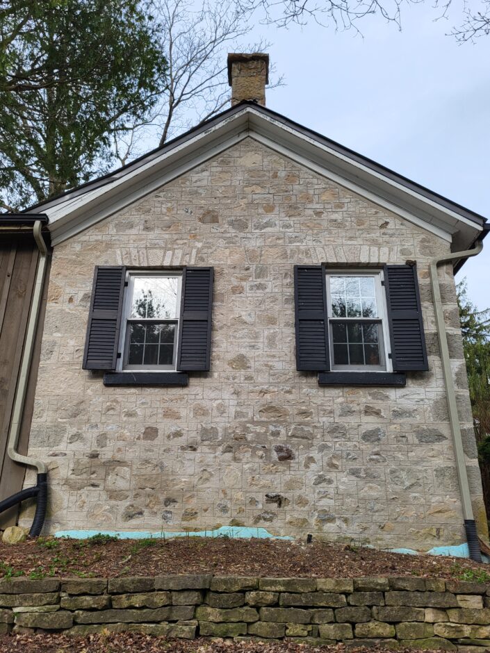
Tradesmen and merchants arrived with the European settlers, and a number of stonemasons were among those who settled in Puslinch. The Township was part of a ridge of igneous rock (granite) running from Eramosa through Puslinch to Waterloo County that provided the fieldstones for masons to construct the fine examples of Scottish, German, Irish and English masonry found here. They also used Southwestern Ontario layered limestone and sandstone from local quarries like that of John Howitt in northwest Puslinch. A dramatic rise in wheat prices during the Crimean War in the 1850s provided the capital for farm families in Canada West to build these next stages of architecture.
All of the photographs below are from the pictorial heritage inventory of Puslinch initiated in the year 2000, unless otherwise noted.
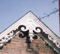
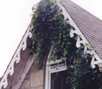
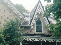
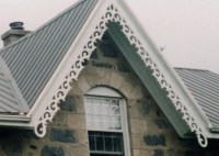
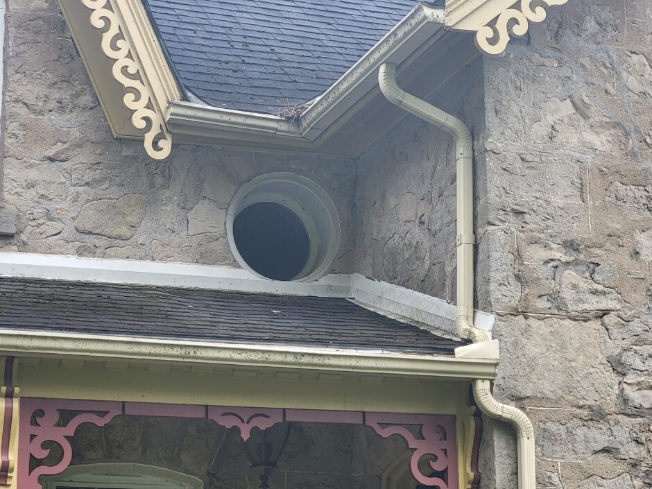
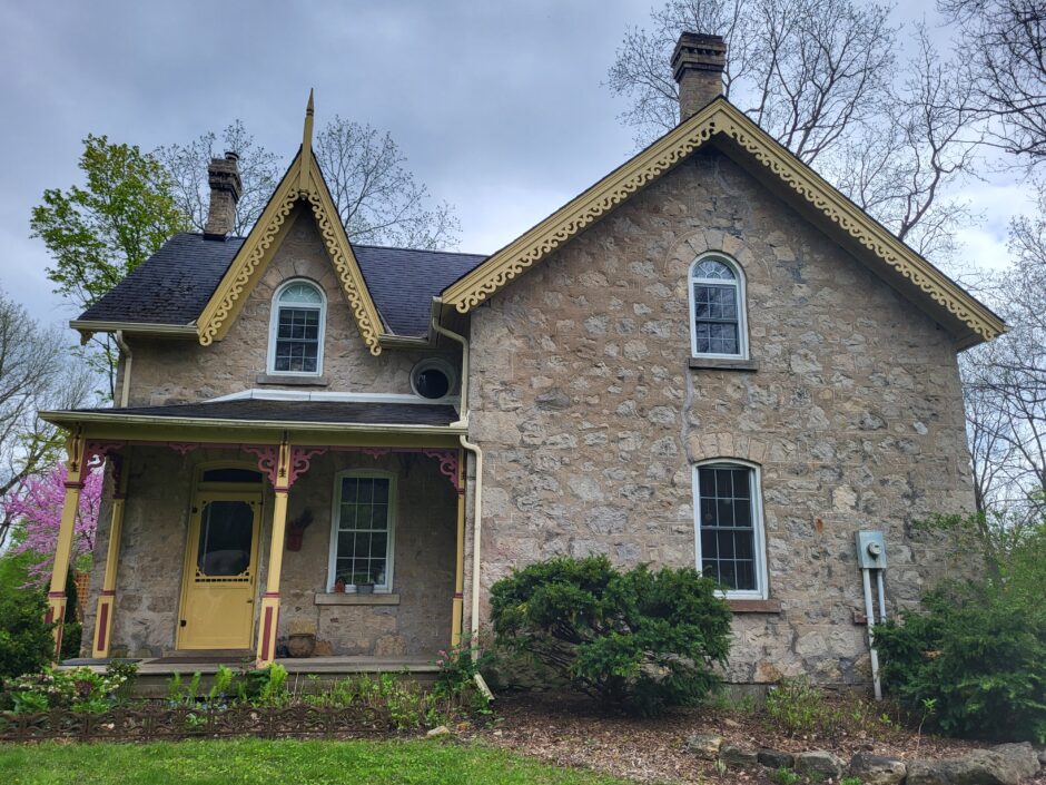
Carpenter Work
A piece of Puslinch heritage that still remains to be seen today is the beautiful carpenter work on some of the older buildings in the Township. Below are photographs that illustrate the artwork that adorn local buildings in Puslinch.
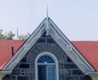

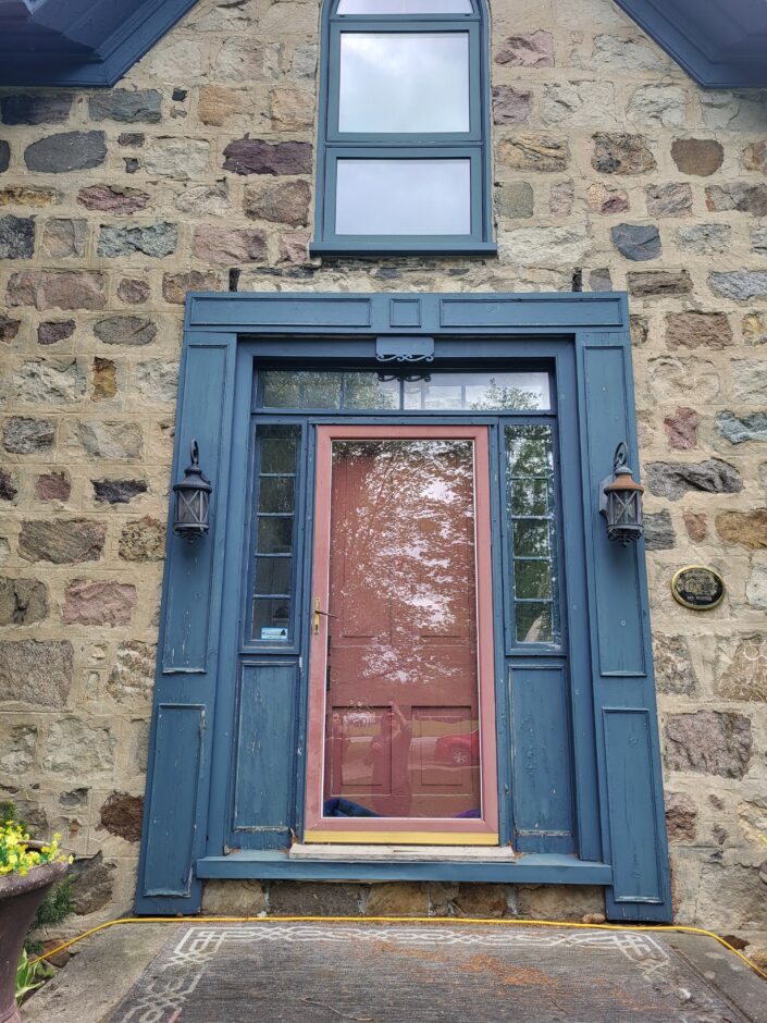
Masons
The stonemasons in Puslinch were Scottish, Irish, English, German, and Prussian, and their work exhibits different styles reflecting their origins.
Architectural Heritage of Puslinch Presentation
This presentation expands on the above information and explores three different stages of architecture in Puslinch and individual features such as windows, masonry styles and carpentry work.
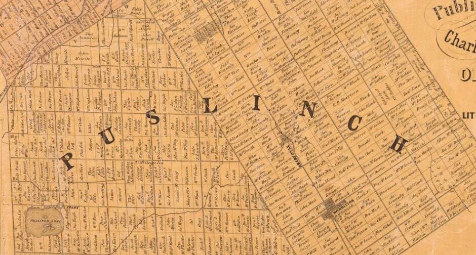
Historical Maps
The following historical maps illustrate the geographical changes that Puslinch has experienced over the years.